Tools & Techniques
Using Satellites to Reveal the Burning of the UK’s Protected Moorlands
|
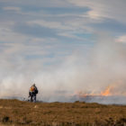
How Greenpeace’s investigative site, Unearthed, used satellite imagery and database mapping to reveal hundreds of fires on environmentally protected land in the English moors – including dozens that could be illegal.
