Resources for Finding and Using Satellite Images

This 2023 edition of the guide was compiled and written by Ryan McNeill, deputy data journalism editor, Reuters; Deborah Nelson, professor of investigative journalism, Philip Merrill College of Journalism, University of Maryland; and Toby McIntosh, independent journalist and former director of the GIJN Resource Center. Satellites are a powerful investigative tool.

Climate Change Reporting Guide - Chapter Two

Climate Change Reporting Guide: Methane — Chapter 2

Thanks to new technologies, the direct sources of methane emissions — particularly natural gas and oil production — now can be exposed, a difficult but crucial first step in holding emitters accountable. At the moment, these techniques are not easily accessible to journalists, but collaborative possibilities exist.

Deepfake Geography: How AI Can Now Falsify Satellite Images

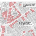
With more sophisticated AI technologies emerging, researchers warn that “deepfake geography” could become a growing problem. As a result, a team of researchers that set out to identify new ways of detecting fake satellite photos warn of the dangers of falsified geospatial data and call for a system of geographic fact-checking.