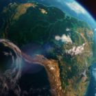
Satellite imagery of the Amazon forest

Journalists’ Guide to Using AI and Satellite Imagery for Storytelling

Satellite imagery provides information that can enhance the ability to write compelling narratives about the state of our planet, cutting across multiple beats. But such a tool tends to be complex and out of the reach for many journalists, so this guide offers a process that reporters interested in covering the climate crisis can use for story projects.

Telegram, app, Russia

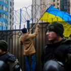
Tips for Archiving Telegram Messages on Russia-Ukraine War

With Facebook blocked and Twitter restricted, Telegram is one of the last social network applications fully accessible to internet users in Russia. Archiving Telegram reports of military engagements from on the ground in Ukraine ensures any evidence can still be used by researchers if a user deletes a post, if a channel is removed, or if an entire platform becomes inaccessible.

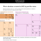
GIJN Webinar: How Journalists Investigated the Killing of Shireen Abu Akleh

The controversial killing of Shireen Abu Akleh has drawn global media attention and sparked a number of in-depth inquiries by the news media. Two of the most comprehensive investigations were done by Bellingcat and the Washington Post – and members from both teams will be joining this GIJN webinar. 

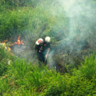
Investigating Forest Fires Amid a Data Vacuum in Venezuela

In March 2020, environmental journalist Helena Carpio, leaned out of her window to see Caracas filled with smoke. Something was burning, but no one knew where and there was no official news on what was happening. She started to investigate, and the resulting project analyzed two decades of satellite data on hotspots to explore the when, where, and why of forest fires in Venezuela and across Latin America.