How to Expose Lies from the Skies Using Satellites and Drones

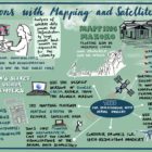
In a GIJC21 session on using maps and satellite imagery for investigations, three experts explained their approaches to analyzing satellite and drone images, and using open source tools. One of the innovative techniques described led to a Pulitzer Prize this year — for exposing China’s network of Muslim detention centers — while another exposed government deception about fires in the Amazon, and a third literally put a vulnerable community in Africa on the map.

Investigating Illegal Gold Mining in the Amazon

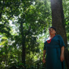
In the 1990’s when Brazilian investigative journalist Kátia Brasil visited an Indigenous territory in the Amazon biome, the forest was “lush” and intact. But illegal gold mining has led to a surge of outsiders entering the area, and the results have been devastating. Two investigative teams, at Amazônia Real and Repórter Brasil, decided it was time to dig into this secretive industry, to find out who is behind the gold mining that is leaving a toxic scar across the region.

My Favorite Tools: Geo-Journalist Gustavo Faleiros

For our “My Favorite Tools” series, we spoke with Brazilian journalist Gustavo Faleiros, editor of environmental investigations at the Pulitzer Center where he leads the Rainforest Investigations Network (RIN), about mapping deforestation and using data to chart what is happening in global forests.

GIJN’s Data Journalism Top 10: Amazon.com, the Menstrual Cycle, Canadian Sex Crimes, Nonsensical Diagrams

What’s the global data journalism community tweeting about this week? Our NodeXL #ddj mapping from July 8 to 14 finds BBC News analyzing Afghan election results as well as graphing the milestones of the 25-year-old Amazon empire, Federica Fragapane visualizing the female menstruation cycle for Scientific American, and Bloomberg taking a closer look at China’s domination of the South China Sea. We also have a fun piece by Alberto Cairo on nonsensical diagrams.