Thanks to new technologies, the direct sources of methane emissions — particularly natural gas and oil production — now can be exposed, a difficult but crucial first step in holding emitters accountable. At the moment, these techniques are not easily accessible to journalists, but collaborative possibilities exist. And, fortunately, more options are becoming available.
Odorless and colorless, methane is invisible to the naked eye, making actual measurement complicated. Detection requires infrared cameras, spectrometers, and other specialized equipment that is expensive and can require detailed training. The scientific literature can likewise be inscrutable at times for the untrained, employing arcane phrases such as plume geometries, persistence weighting, and glint mode. As a result, journalists must typically rely on expert sources and other third parties for emissions information and data analysis.
Although corporations do their own testing and monitoring, they rarely disclose their data and usually oppose government efforts to establish reporting standards and require transparency. Still, the most obvious target for scrutiny is the fossil fuel industry, even though methane emissions also come from landfills, wastewater treatment, mining, agriculture, and other sources.
Breakthrough Detection Tools
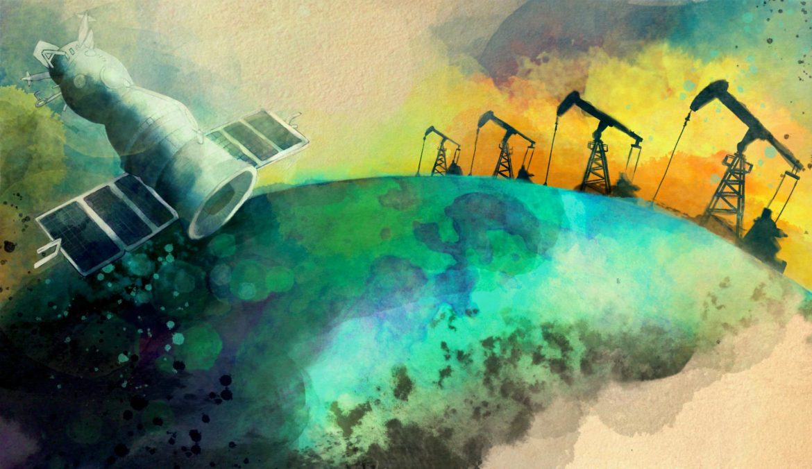
‘Top Down’ Approach: Here Come the Satellites
To quantify methane emissions, spectrographic research is necessary. (Laser-spectrometer sensors measure the amount of light absorbed by the gas and translate that information into a methane concentration number.) This equipment is sophisticated and expensive. Observations are made mainly from drones, planes, and satellites, meaning the technical nature of the work throws up serious practical hurdles for journalists from all but the largest news outlets. Still, the use of satellites in tracking emissions can be a potential game changer for making the data on methane much more complete.

The TROPOspheric Monitoring Instrument (TROPOMI) on board the EU’s Copernicus Sentinel-5 Precursor satellite tracks methane emissions. Image: Courtesy of ESA
“Self-reported, unverified emissions estimates based on paper exercises are barely worth the paper they’re written on,” is the blunt assessment of Ben Ratner, senior director of the Environmental Defense Fund (EDF), and Erin Blanton, senior research scholar at the Center on Global Energy Policy at Columbia University. “Instead, as the satellite age dawns, the key metric is methane intensity as verified and reported with actual measurement, as bp has committed to in recent weeks,” they wrote in a 2020 blog post, referring to BP plc, the big British multinational oil and gas company.
Satellites also enjoy additional deployment and logistical benefits over other measurement techniques. “A key advantage of satellite detection systems is their ability to provide recurring measurements over large, even global, geographies,” noted this 2020 Center on Global Energy Policy report. The accuracy of the satellite images depends on the degree of resolution, but it can be pretty specific. Major hotspots have been identified. For example, a study published in 2021 evaluated 1,100 emission sources in the US Permian Basin — in the southwestern United States (Intermittency of Large Methane Emitters in the Permian Basin).
Ultra-emissions by oil and gas producers contribute 8% to 12% of the overall oil and gas production emissions, according to a 2022 study of satellite data by a team of scientists, described in this Science News article. Over a two-year period, they found 1,800 plumes, with 1,200 of them being associated with oil and gas activities. “Mitigation of ultra-emitters,” the scientists wrote, “is largely achievable at low costs and would lead to robust net benefits in billions of US dollars for the six major oil and gas-producing countries when considering societal costs of methane.”
For more examples of using satellite data to investigate methane, see these articles in Smithsonian Magazine, YaleEnvironment360, Forbes, and Bloomberg.
‘Bottom Up’ Detection: Infrared, Visualizing the Invisible
“Top down” research from the sky buttresses research on the ground, known as “bottom-up” research, to create estimates of global methane emissions, but can also examine specific sites. Identifying suspected emissions or leak sites often begins with more localized investigations.
Spectacular images of spewing methane plumes in orange, red, and other colors, can be taken with infrared (IR) cameras, a method also referred to as Optical Gas Imaging (OGI). As a result, IR data can provide striking visuals and dramatic evidence of specific emissions or leaks as part of an investigative story.
However, these cameras cost more than $100,000 and require special training and experience to use them correctly, making them an inaccessible resource for most reporters. Infrared imagery also has other limitations. As a detection tool, infrared imaging is almost exclusively qualitative in nature, since it can’t measure how much methane is being emitted. Plus, emissions can be sporadic. Still, unmistakable proof of individual emissions sites can generate reasons to follow-up with companies and regulators. Plus, the colorful IR images serve as a great storytelling element and work to more vividly illustrate what is an inherent problem of tracking methane emissions: the gas is invisible.

A methane plume is detected by infrared cameras in Minerbio, Italy. Image: Courtesy of Clean Air Task Force
Infrared photography was used to great effect in a 2019 New York Times article, It’s a Vast, Invisible Climate Menace. We Made It Visible, by Jonah M. Kessel and Hiroko Tabuchi. Kessel later wrote about how they did it, describing the complicated camera and computer set-up they employed, commenting, “It was not easy.”
Another complication: getting close enough to a methane leak to deploy an infrared camera without trespassing or breaking other laws can be difficult. These cameras are designed to work at a range of five to 10 meters, though they can capture large events at up to 400 meters. In addition, the background and ambient weather conditions can have an effect on image quality.
Potential NGO Sources and Partners
Clean Air Task Force
GIJN has identified two environmental groups with infrared cameras that are willing to work with reporters. They could prove to be invaluable partners when trying to conduct an on-the-ground investigation of possible methane emitters.

A 2021 Clean Air Task Force report on methane emissions in Europe. Image: Screenshot
The first of these is the Clean Air Task Force, based in Boston and Amsterdam. The CATF has documented emissions from oil and gas facilities across Europe and is looking to expand to other regions. CATF documented 433 methane emitting sources across Europe’s oil and gas network, according to a December 2021 report, and it has archived videos in an online library. Here’s a YouTube description of the project and an explainer on its use of infrared (OGI) technology.
James Turitto is CATF’s infrared cameraman and he often travels with journalists to evaluate sites, typically liquefied natural gas terminals, storage facilities, and pipelines. Possible emissions locations are found based in part on information from governments and corporate websites, including sources such as Gas Infrastructure Europe, and a target map Turitto created with data collected by the German DLR Institute.
Turitto turned the camera on four dozen sites in Romania in June 2021, almost all of which were emitting methane, as described in articles published by Bloomberg Green and Desmog. His research on 10 sites in Hungary was documented in a 2021 article by István M. Szabó on Napi.hu. The reporter sought explanations from the main company examined. The corporation’s dismissive reply said the leaks detected were “part of normal operation” and that the company was committed “to achieve carbon neutrality.” For more on Turittos’ work, check out this behind-the-scenes video on his top five investigations.
Journalists interested in working with a CATF camera operator should contact Rowan Emslie.
Earthworks

Earthworks revealed massive methane flaring in Texas in a 2021 report. Image: Screenshot
Another NGO with infrared camera capability and a willingness to collaborate with journalists is Earthworks, based in Washington, D.C. Infrared images captured by Earthworks were used by the Columbia Alliance Against Fracking, which displayed them to the media in 2019. This is a video about their work (in Spanish) with English subtitles. Also see Earthworks YouTube channel.
Earthworks used infrared research from flyovers in a 2021 report to uncover massive amounts of unauthorized flaring in the US state of Texas. The report compared the actual number of methane gas flares — which involves the burning off of flammable waste gases — against the state regulator’s official database to determine that a vast majority — anywhere from 69% to 84% — of the flares were unpermitted.
The group also makes regular investigative trips across different regions in the United States. Earthworks has field staffers in the US states of Colorado, New Mexico, Texas, Louisiana, and Pennsylvania.
Reporters interested in working with certified thermographers — who operate the infrared cameras — from Earthworks to document methane and VOC pollution should reach out to Justin Wasser or Josh Eisenfeld.
Satellites Monitor Flaring at Night
Data about flaring of natural gas worldwide, as seen by satellites at night, is provided by VIIRS Nightfire and is repurposed in the SkyTruth Flaring Map.
Flaring is the burning of natural gas emissions and results in emissions of carbon dioxide, methane, and other pollutants.
The VIIRS Nightfire data is based on infrared observations (see description) and is updated daily. Access requires a sign-up with Earth Observation Group, a project by the Colorado School of Mines. Here is a basic walk-through of the data download options.
SkyTruth, a US environmental group, clusters Nightfire’s flaring data both spatially and temporally in monthly reports. The SkyTruth Alerts map can be found at alerts.skytruth.org. To get the Monthly Flaring Summary layer, you’ll need to register for a free account and login.
Sources of Satellite Data on Emissions
Many companies monitor methane emissions via satellite for private clients, including investors, bankers, and insurers.
Some of these providers disclose findings of interest to journalists and may offer discount prices for their data. Several major media outlets are clients.
To varying degrees, the private companies rely heavily on data from EU satellites, but that public information comes with limitations that make it hard to identify “point source” emissions. The resolution of the images is too coarse. To detect methane emission plumes one needs resolution in the 30-meter range, explained Riley Duren, a former NASA scientist now heading Carbon Mapper, a US nonprofit consortium that plans to launch precise methane-sensing satellites in 2023. The resolution number refers to the size of the smallest possible feature that can be displayed in a satellite image.
The EU Sentinel satellites “are good at finding very large ‘ultra emitters,’” Duran said, but those “are mostly seeing planned maintenance events like blowdowns and the occasional short-lived leak.” Duran continued, “The vast majority of fugitive emissions including sustained leaks are well below the detection limits of those systems.”
Other complications were pointed out by Mark Kriss, chief executive officer of the US company Geofinancial Analytics, who said, “It is non-trivial to download, process, validate, and analyze observations from the scientific satellites. And that’s only the first part of the challenge. You then need to attribute these observations to who owns the assets on the ground. All of this requires advanced analytics and highly-specialized scientific know-how plus asset-level data.”
Sources for Images of Methane Emissions
Satellite images can help journalists identify methane emissions from sources including petroleum extraction and transmission, coal mining, and landfills. Here are several sources of free satellite data.
Earth Surface Mineral Dust Source Investigation (EMIT) is a new resource from NASA, the US National Aeronautics and Space Administration. The portal “shows high-confidence research grade methane plumes from point source emitters – updated as they are identified.” Clicking on the red circles will show the time and concentration of the emissions.
GHGSat Spectra reveals a selection of major emissions worldwide, although not with pinpoint accuracy and with a time delay of several weeks. (Sign up is required for access.) On the Spectra map, click in the upper right on the “Analytics From” box to change the dates of data shown. Click the triangles on the map to see details on each release. See “?” for more information. Spectra cautions: “Whilst we can see methane concentrations, it is not possible to use the map to identify specific sources of methane.” GHGSat is a company that sells more detailed information, hence its offers to “upgrade to SPECTRA Premium,” which a spokesman said, “would range from the tens to the hundreds of thousands of dollars depending on coverage and options selected.”
SRON shows methane emission plumes worldwide. It is produced by the Netherlands Institute for Space Research. The map is updated about every week and shows approximate source locations, but the resolution is low. A chart shows the locations by longitude and latitude (not the country). This presents a bit of a challenge, but putting the coordinates into Google Maps will show the location. Or try other coordinates converters.
SATALERT shows methane concentration levels, searchable by date. The map shows area-wide levels, not linked to specific sources. There is more background about how to use SATALERT, the creation of Australian researcher Dan Moss. By choosing different time periods, it’s possible to distinguish between intermittent high concentrations of methane, such as a large emission on one day, compared to a lower but steady concentration release. The images that SATALERT uses come from the EU’s Sentinel-5P satellites and have a resolution of 7.5-by-5 kilometers (4.65-by-3.1 miles) per pixel, which limits identification of specific facilities. However, to go deeper, SATALERT uses Sentinel 2 data for 20-meter resolution. Moss encourages reporters to contact him.

In August 2021, scientists used data from the Copernicus Sentinel-5P mission and GHGSat’s commercial imagery to identify two of the largest emissions sites in Europe, in Madrid landfills. Image: Screenshot, Sentinel-5P
Chasing Methane from IndiaSpend is that country’s first methane tracker and monitors emissions in India across various sectors. Data gathered between January and September 2022 shows emissions from landfills in cities including Mumbai, Pune, and Bengaluru. The nongovernmental organization contracted with a private company to analyze data from EU satellites. The plan is to update the site monthly.
Also watch for scientific research on methane emissions. For example, this study describes “carbon bombs,” or potential fossil fuel resources whose use would result in substantial methane and carbon dioxide emissions. An environmental group, LINGO, extracted data from the study about what it similarly termed “methane bombs,” broken down by country.
Finally, there are commercial sources for emissions information based on satellite images. They sometimes provide information for free and offer discounts to journalists. Commercial providers include Geofinancial Analytics and Kayrros.
Kayrros recently released data on major emissions in 2023 to The Guardian, which did an extensive article: Revealed: 1,000 super-emitting methane leaks risk triggering climate tipping points. A Kayrros spokesperson said reporters could request the database, which has country-by-country information, and will be updated quarterly. Reporters also could ask for additional information about emissions in their countries.
Still on the Horizon
Several other sources are poised to start providing data.
NASA also recently announced that observations from EMIT and other NASA science instruments will be part of a global survey of point-source emissions of methane from solid waste sites such as landfills. The multi-year effort is being developed and conducted by the US nonprofit consortium Carbon Mapper, which is planning its own methane-sensing satellites to be launched later in 2023.
MethaneSAT: Being developed by a subsidiary of the Environmental Defense Fund (EDF), a nongovernmental organization. MethaneSAT will not provide data until mid-2024. However, measurements using similar spectrometers aboard aircraft flying over limited areas may start in early 2023.
Global Methane Hub, SRON and GHGSat: Announced in November 2022, this joint project is focused on landfills around the world.
The Methane Alert and Response System (MARS): This international methane tracking effort, run by the UN Environmental Programme, will start issuing data in the second half of 2023, according to officials. However, information will not be made public until 45 to 75 days after the detection on an emission. This gap will allow IMEO to consult with the emitters. In 2022, MARS officials provided images to journalists about 2022, but this practice appears to have ended.
Other Monitoring Techniques
There are other ground-based ways to monitor emissions, but their utility for journalists is limited at this time. This is unfortunate, particularly because it limits direct media reporting on natural gas distribution systems and emissions during transmission is a significant issue. There are 630,000 methane leaks annually in US natural gas distribution pipes, according to a 2020 academic study, which also found that real emissions are five times that of official figures.

Google’s Air View pilot project, since discontinued, mapped air pollution, including methane. Image: Courtesy of Google
Understanding the tools used to uncover leaks can help with inquiries to company and government officials. Vehicle-based sensors have and are being used, most notably in a now discontinued effort involving Google.
Google added methane sensors to its roving Street View cars in the US, detecting methane leaks from local distribution systems in selected cities from 2010 to 2019. The project was described in a paper in Environmental Science and Technology. Maps showing the results were posted by Google and by the EDF, a partner in the project. Articles about the project appeared in The Washington Post and USA Today. Google still cites Project Air View on its website, but it is no longer active.
Strategies for identifying leaks are complicated. Recently a Massachusetts-based advocacy group, Gas Leaks Allies, looked for possible emissions leaks by analyzing the reports that gas companies must file with the state detailing the type and cost of repairs, as described in an October 2021 Boston Globe article. Likewise, a November 2021 study published in the Proceedings of the National Academy of Sciences, found higher than reported rates of leakage in Boston. Another local group in Massachusetts, Heet, uses public data to create detailed leak maps.
Some scholarly researchers continue to use vehicle-mounted sensors. For more, see this 2021 journal article. A similar car-based detection methodology was used for a study entitled Mapping Urban Methane Sources in Paris, France. It concluded: “Our findings suggest that the natural gas distribution network, the sewage system, and furnaces of buildings are ideal targets for street-level [methane] emission reduction efforts for Paris.”
And there are several other innovative detection methods being tried and tested:
- A ground-based study in Krakow, Poland, measured the different isotopes present in methane that come from natural gas leaks, coal emissions, landfill and sewage, and livestock to differentiate the possible sources of the leaks.
- One group of US scientists used a network of sensors installed on mobile-phone towers to track emissions in the Permian Basin, according to a Bloomberg report, The Methane Hunters. Also see The Permian Methane Analysis Project.
- A system called “agricomb” can sense gas emissions from farms, according to a 2020 article in Optics and Photonics (more detail in Science), although, again, this system isn’t useable by journalists.
- Handheld laser devices are less expensive than infrared cameras and can detect methane, but still require technical savvy.
- Most humorously, expensive backpack-size air-monitoring devices, made by the US company Picarro, were used by researchers to show heightened levels of human-sourced methane — burps and farts, essentially — at the Oktoberfest beer festival in Germany.
Investigative Journalism Takeaways
What does this all that mean for reporters looking at a story on methane emissions? It’s likely not possible for journalists to conduct their own basic research, but it probably makes sense to look for public documents, make friends with local scientists and NGOs working in this area, and talk with gas workers.
As an example, in Australia, researchers used an aerial survey to document high methane emissions in Queensland’s main coal seam gas region, as reported by public broadcaster ABC. In Colorado, Aspen Journalism reported on how local activists and scientists documented ongoing methane leaks from abandoned coal mines. Nonprofit news site Capital & Main took advantage of new reporting rules in New Mexico to question numbers from the state’s largest natural gas producer.
Not to be overlooked: asking questions of and seeking documentation from the utilities and others who operate distribution facilities. How many leaks have they detected or repaired?
Challenges of Verification
Seeking comment from the sources of observed emissions is standard journalistic operating procedure, but the answers can be incomprehensible and intimidating.
Those responsible often say that not all emissions are illegal. Or as the reporter following up on unauthorized emissions in Hungary was told: leaks were “part of normal operation” and that the company was committed “to achieve carbon neutrality.”
In this December 2021 story in Bloomberg Green, reporter Josh Saul asked questions not only of company officials but also of state government officials, who said they had no plans to investigate. Saul was reporting on leaks revealed by Kayross.
Can such corporate answers be verified or challenged?
If consistent measurement were possible, it would be easier to observe patterns, perhaps leading to proof that emissions exceed allowable limits. And if more emissions reporting was required, comparisons of official and unofficial figures could be made.
In the meantime, turning to government regulators, both local and national, as well as knowledgeable NGOs is the best bet for verification. Other potential sources are nearby residents, industry experts, plus employees, or former employees, of the company being investigated. See the GIJN resource: Finding Former Employees.
A good look at the difficulties of reporting on emission explanations is provided in a 2021 article by Bloomberg reporters, Naureen Malik and Aaron Clark: Satellites Spot Methane Plumes over US Caused by “Routine Work.”
Chapter Three covers how to probe emissions reductions pledges by companies.